


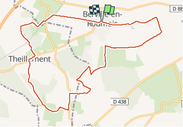
20111217-Berville en Roumois

doudet
User

Length
11.6 km

Max alt
147 m

Uphill gradient
151 m
Km-Effort
13.6 km

Min alt
98 m

Downhill gradient
150 m
Boucle
Yes
Creation date :
2019-07-02 07:22:40.338
Updated on :
2019-07-02 07:22:40.338
--
Difficulty : Unknown

FREE GPS app for hiking
 SityTrail
IGN / Geographical institutes
SityTrail Plus
The world is yours!
About
Trail Walking of 11.6 km to be discovered at Normandy, Eure, Les Monts du Roumois. This trail is proposed by doudet.
Positioning
Country:
France
Region :
Normandy
Department/Province :
Eure
Municipality :
Les Monts du Roumois
Location:
Unknown
Start:(Dec)
Start:(UTM)
341769 ; 5462655 (31U) N.
Comments